
Austin site model and feasibility data
Elevation, aerial imagery, building footprints, roads and more for downtown Austin, from the Capitol to Lady Bird Lake, in files you keep.
Mantle Place builds a site model of Austin: elevation, aerial imagery, buildings and more, in one georeferenced bundle. The pre-drawn area covers downtown Austin: 1,191 acres, with public parcel and zoning records in reach.
What a bundle carries here
- Area
- 1,191 acres (4.8 km²). Downtown Austin, from the Capitol grounds south across Lady Bird Lake to the foot of South Congress, between Shoal Creek and Waller Creek.
- Price
- $15 for the pre-drawn area, once. Keep the files.
- Elevation
- USGS 3DEP 1 m (1 m here), then 3DEP 1/9″ (3.42 m here), then 3DEP 1/3″ (10.26 m here). Mapterhorn (30 m) backs it.
- Imagery
- NAIP aerial photography where it covers the site, otherwise Copernicus Sentinel-2, in the bundle.
- Buildings and roads
- Building footprints and the road network ship for the area.
- Flood map
- FEMA flood zones ship for the area.
- Parcels
- Statewide, except Donley County, from Texas Geographic Information Office (TxGIO), Texas Water Development Board (StratMap Land Parcels, from county appraisal districts)
- Zoning
- City of Austin, from City of Austin, Geospatial Services - Data Development
- Sample
- Download the Austin Downtown sample free, to see the files before you order.
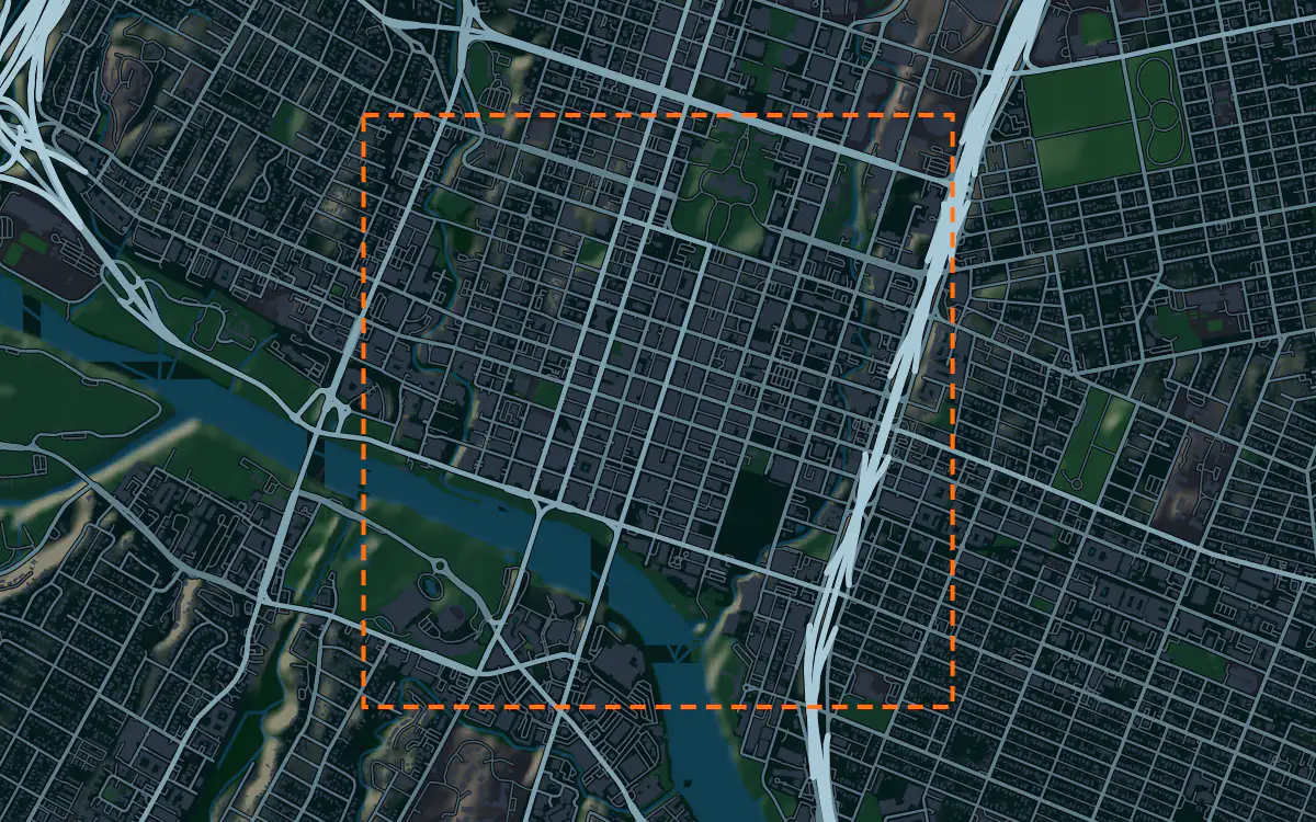
A site model
Downtown Austin is a slope, not a plain. The ground climbs from Lady Bird Lake up Congress Avenue to the Capitol, and Shoal Creek and Waller Creek cut the grid on either side. A site three blocks from the water can have a very different relationship to the street than one near the Capitol, and a terrain model shows that difference before a design team commits to a podium height.
Views are the other Austin constraint. The state protects corridors that keep the Capitol dome visible from points around the city, and those corridors cap how tall a building can rise along them. Put the extruded footprints and the terrain into your design tool, place a camera at the street, and you can test whether a massing sits in a view before you read the ordinance.
The aerial imagery shows the lake edge, the trail along it, the bridges, and the cranes of a downtown that keeps rebuilding itself. Draped on the terrain, it gives a presentation model the water and the green of the shoreline that make Austin look like Austin. Designers take the downtown Austin bundle into Unreal, Revit, AutoCAD, and more.
A feasibility kit
Austin feasibility starts with the record. Where public parcel and zoning layers reach your area, the figures above say so and the bundle carries them clipped to the same boundary as the terrain, so you can see the lot lines and the zoning district on the slope of the ground, in one drawing instead of three downloads from three portals.
Creeks are the local risk. Waller Creek and Shoal Creek both flood, and much of the downtown edge sits near mapped flood zones and their buffers. Lay the flood map and the contours over a parcel and you can see how much of it is buildable before a civil engineer is on the clock.
For a larger tract on the edge of the metro, draw the whole parcel and read it in acres, then pull contours and a surface into Civil 3D for concept grading. It is public data for screening and early design, so confirm boundaries and grades with a survey before you close.
Next: topography and contours for a large tract and a Civil 3D surface from lidar.
Public data for concept grading. Confirm boundaries and grades with a site survey.
Frequently asked
Can I check a Capitol view corridor on an Austin site?
You can build the test yourself: import the terrain and the extruded footprints into your design tool, set a camera on the street, and see whether the massing blocks the dome. The corridors themselves come from the city, so confirm the limits with its ordinance.
How do I see flood risk from Waller Creek or Shoal Creek?
It shows where the mapped zones fall on the lot, which is enough to screen a site before an engineer confirms the floodplain.
Keep the data for Austin.
Open the pre-drawn 1,191 acres in the curator, move or resize it, and download a bundle you keep.
Native plugins: Mantle Place for Unreal, Mantle Place for Revit, and Mantle Place for AutoCAD.
Open this area in the curator