
Collin County site model and feasibility data
Elevation, aerial imagery, building footprints, roads and more anywhere in Collin County, opened here on historic downtown McKinney.
Mantle Place builds a site model of Collin County: elevation, aerial imagery, buildings and more, in one georeferenced bundle. The pre-drawn Collin County area covers historic downtown McKinney: 1,195 acres, with public parcel records in reach.
What a bundle carries here
- Area
- 1,195 acres (4.8 km²). Historic downtown McKinney, around the courthouse square and the shops of the older blocks, with the neighborhoods on every side.
- Price
- $15 for the pre-drawn area, once. Keep the files.
- Elevation
- USGS 3DEP 1 m (1 m here), then 3DEP 1/9″ (3.42 m here), then 3DEP 1/3″ (10.27 m here). Mapterhorn (30 m) backs it.
- Imagery
- NAIP aerial photography where it covers the site, otherwise Copernicus Sentinel-2, in the bundle.
- Buildings and roads
- Building footprints and the road network ship for the area.
- Flood map
- FEMA flood zones ship for the area.
- Parcels
- Statewide, except Donley County, from Texas Geographic Information Office (TxGIO), Texas Water Development Board (StratMap Land Parcels, from county appraisal districts)
- Zoning
- No public zoning source covers this area yet.
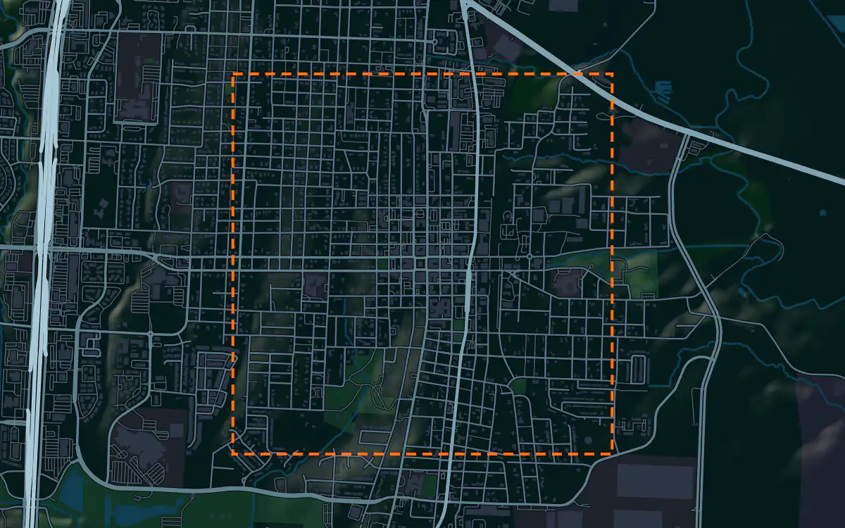
A site model
Collin County is Blackland prairie, rolling farmland that the Dallas region has been covering with subdivisions and offices for decades. McKinney sits on a gentle rise, and the terrain in the bundle shows the swells and the creek lines that drain the town.
The courthouse square is the center of the context, with a historic district of low brick and stone buildings around it and old trees in the neighborhoods beyond. The low brick and stone blocks set the scale a proposal must answer, and the imagery shows the square and the newer streets at the edge. Designers take the historic downtown McKinney bundle into Unreal, Revit, AutoCAD, and more.
A feasibility kit
Collin County is one of the largest growth counties in Texas by Census estimates, and the first look at a tract is the same each time: its size in acres, the lot lines, the zoning and the ground.
Blackland clay swells and shrinks, a job for a geotechnical report, and the creeks set the flood zones.
Next: topography and contours for a large tract and a Civil 3D surface from lidar.
Public data for concept grading. Confirm boundaries and grades with a site survey.
Frequently asked
Can I screen a large tract on the edge of Collin County?
Draw your site and the bundle lays the FEMA flood map over the contours; the map covers historic downtown McKinney.
Which public records reach historic downtown McKinney?
Public parcel records reach historic downtown McKinney, clipped to its edge; the figures above name the sources.
Keep the data for Collin County.
Open the pre-drawn 1,195 acres in the curator, move or resize it, and download a bundle you keep.
Native plugins: Mantle Place for Unreal, Mantle Place for Revit, and Mantle Place for AutoCAD.
Open this area in the curator