
Dallas site model and feasibility data
Elevation, aerial imagery, building footprints, roads and more for downtown Dallas, from the Arts District to the Trinity River levees, in files you keep.
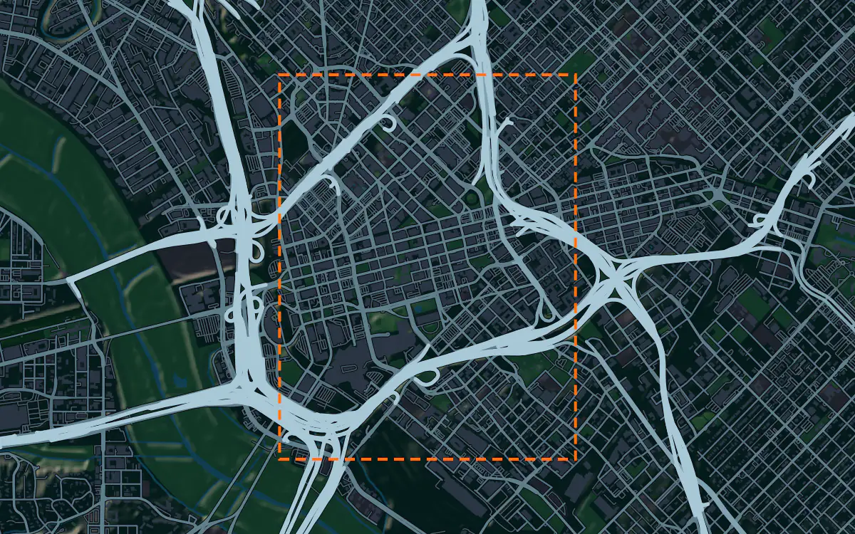
Mantle Place builds a site model of Dallas: elevation, aerial imagery, buildings and more, in one georeferenced bundle. The pre-drawn area covers downtown Dallas: 1,564 acres, with public parcel and zoning records in reach.
What a bundle carries here
- Area
- 1,564 acres (6.3 km²). Downtown Dallas, from the Arts District and the deck park over the freeway south past the convention district, with Deep Ellum at the eastern edge.
- Price
- $18 for the pre-drawn area, once. Keep the files.
- Elevation
- USGS 3DEP 1 m (1 m here), then 3DEP 1/9″ (3.42 m here), then 3DEP 1/3″ (10.27 m here). Mapterhorn (30 m) backs it.
- Imagery
- NAIP aerial photography where it covers the site, otherwise Copernicus Sentinel-2, in the bundle.
- Buildings and roads
- Building footprints and the road network ship for the area.
- Flood map
- FEMA flood zones ship for the area.
- Parcels
- Statewide, except Donley County, from Texas Geographic Information Office (TxGIO), Texas Water Development Board (StratMap Land Parcels, from county appraisal districts)
- Zoning
- City of Dallas, from City of Dallas GIS Services
A site model
Dallas is built on blackland prairie, and downtown looks flat until you put a terrain model under it. The ground falls toward the Trinity River on the west side, and the levees and floodway that hold the river back show up as real shapes in the surface, which matters when a design looks across them toward the skyline.
The skyline is the other half of a Dallas context model. Extrude the footprints, set a camera on the deck park or in the Arts District, and you can test a tower against the glass crowns that define the view. The aerial imagery adds the freeway loops that wrap the core, so a presentation model reads as Dallas rather than as a generic grid. Designers take the downtown Dallas bundle into Unreal, Revit, AutoCAD, and more.
A feasibility kit
Infill in Dallas begins with a tight lot and a clear picture of what surrounds it. The figures above list which public parcel and zoning layers reach this ground, and the bundle sets each beside the terrain, so a developer can see lot lines and districts against the slope of the site without opening a separate portal for each.
The river is the large-scale risk. Land between downtown and the Trinity floodway can sit in or near mapped flood zones, and the flood map where it reaches the site belongs in the first screening drawing, with the contours beneath it. Treat all of it as public data for early design and confirm boundaries with a survey before you close.
Next: topography and contours for a large tract and a Civil 3D surface from lidar.
Public data for concept grading. Confirm boundaries and grades with a site survey.
Frequently asked
Can I get a site model for Fort Worth, not just downtown Dallas?
Yes. Draw your own area anywhere in the metro, Fort Worth included, and the bundle is built for that boundary with the same terrain, imagery, buildings, roads and more.
How do I check the Trinity River flood zone on a Dallas site?
Draw your site and the bundle lays the FEMA flood map over the contours; the map covers downtown Dallas.
Keep the data for Dallas.
Open the pre-drawn 1,564 acres in the curator, move or resize it, and download a bundle you keep.
Native plugins: Mantle Place for Unreal, Mantle Place for Revit, and Mantle Place for AutoCAD.
Open this area in the curator