
Lake County site model and feasibility data
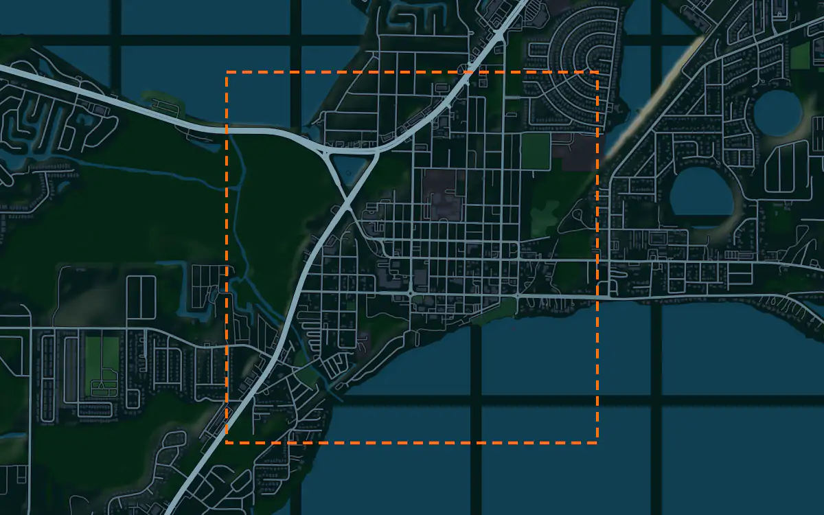
Elevation, aerial imagery, building footprints, roads and more anywhere in Lake County, opened here on downtown Tavares.
Mantle Place builds a site model of Lake County: elevation, aerial imagery, buildings and more, in one georeferenced bundle. The pre-drawn Lake County area covers downtown Tavares: 1,198 acres, with public parcel records in reach.
What a bundle carries here
- Area
- 1,198 acres (4.8 km²). Downtown Tavares on Lake Dora, the county seat, around the courthouse and the lakefront blocks.
- Price
- $15 for the pre-drawn area, once. Keep the files.
- Elevation
- USGS 3DEP 1 m (1 m here), then 3DEP 1/9″ (3.42 m here), then 3DEP 1/3″ (10.26 m here). Mapterhorn (30 m) backs it.
- Imagery
- NAIP aerial photography where it covers the site, otherwise Copernicus Sentinel-2, in the bundle.
- Buildings and roads
- Building footprints and the road network ship for the area.
- Flood map
- FEMA flood zones ship for the area.
- Parcels
- Statewide, from Florida Department of Revenue, Property Tax Oversight (statewide parcel map, from the 67 county property appraisers)
- Zoning
- No public zoning source covers this area yet.
A site model
Lake County is among the hilliest of Florida’s peninsula counties, a country of ridges, citrus groves and a chain of lakes. Tavares sits on the shore of one of the lakes, and a terrain model of the extent shows the water edge and the rises that lead away from it.
The context is a small county seat on a lake, with a courthouse, a waterfront and a town known for its seaplane base. Extruded footprints let a designer test a proposal against that scale, and the imagery draws the shoreline, the docks and the neighborhoods of old trees behind. Designers take the downtown Tavares bundle into Unreal, Revit, AutoCAD, and more.
A feasibility kit
Orlando’s growth has pushed into Lake County, and hillside groves are becoming subdivisions. A first look at a tract is its size in acres, the lot lines and the fall of the ground, and the contours matter here more than in most of Florida.
Lakes, wetlands and sinkholes set the constraints, and slopes bring erosion questions during grading.
Next: topography and contours for a large tract and a Civil 3D surface from lidar.
Public data for concept grading. Confirm boundaries and grades with a site survey.
Frequently asked
Can I screen a hillside grove in Lake County?
Draw the whole tract and read it in acres, then cut contours to see the slopes and read the flood map where it reaches the site.
Which public records reach downtown Tavares?
Public parcel records reach downtown Tavares, clipped to its edge; the figures above name the sources.
Keep the data for Lake County.
Open the pre-drawn 1,198 acres in the curator, move or resize it, and download a bundle you keep.
Native plugins: Mantle Place for Unreal, Mantle Place for Revit, and Mantle Place for AutoCAD.
Open this area in the curator