
Los Angeles site model and feasibility data
Elevation, aerial imagery, building footprints, roads and more for downtown Los Angeles, from Civic Center to Bunker Hill, in files you keep.
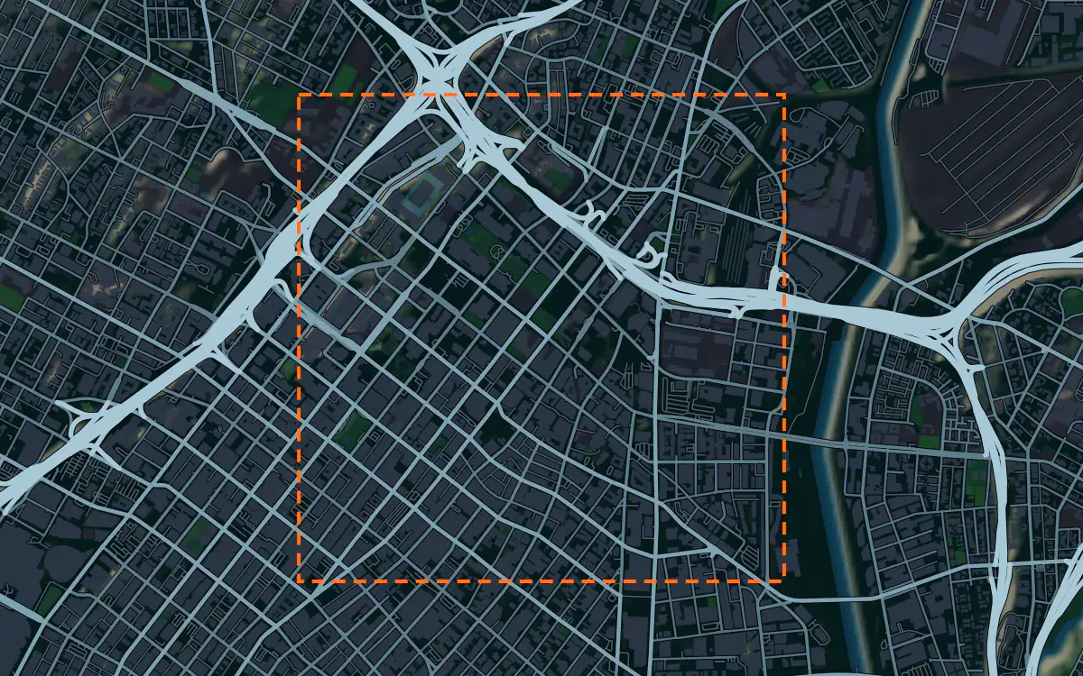
Mantle Place builds a site model of Los Angeles: elevation, aerial imagery, buildings and more, in one georeferenced bundle. The pre-drawn area covers downtown Los Angeles: 1,193 acres, with public parcel records in reach.
What a bundle carries here
- Area
- 1,193 acres (4.8 km²). Downtown Los Angeles, from the Civic Center and City Hall west and south up onto Bunker Hill and into the financial core.
- Price
- $15 for the pre-drawn area, once. Keep the files.
- Elevation
- USGS 3DEP 1 m (1 m here), then 3DEP 1/9″ (3.42 m here), then 3DEP 1/3″ (10.27 m here). Mapterhorn (30 m) backs it.
- Imagery
- NAIP aerial photography where it covers the site, otherwise Copernicus Sentinel-2, in the bundle.
- Buildings and roads
- Building footprints and the road network ship for the area.
- Flood map
- FEMA flood zones ship for the area.
- Parcels
- Los Angeles County, from Los Angeles County Assessor
- Zoning
- No public zoning source covers this area yet.
A site model
Downtown Los Angeles looks like a tower district on a flat plain until you put a terrain model under it. Bunker Hill rises on the west side, and the streets that climb it, with the stairs and the funicular that once served it, are the sharpest relief in the extent. That change in level is why the tall towers read as a stack.
The context is a mix of civic buildings, glass towers, older masonry blocks and the freeway ring that wraps the core. Extruded footprints give a presentation model the skyline, and the imagery draws the river corridor on the east, the rail yards and the street trees. Designers take the downtown Los Angeles bundle into Unreal, Revit, AutoCAD, and more.
A feasibility kit
Los Angeles is a city where slope decides the feasibility of a lot, from Bunker Hill to the canyons beyond. The contours from the bundle show how a lot falls before a grading consultant is hired, and the figures above list the public parcel layers that reach this ground, set beside the terrain.
The basin carries flood and seismic questions, the latter for a geotechnical consultant and not for this data. The public flood map, where it reaches the site, with the contours for the parcel, is the first screening view. Treat it as public data for early design and confirm with a survey.
Next: topography and contours for a large tract and a Civil 3D surface from lidar.
Public data for concept grading. Confirm boundaries and grades with a site survey.
Frequently asked
Can I model the hills and canyons around Los Angeles?
Yes. Draw an area over a hillside or canyon and the bundle carries the steep terrain with the imagery and footprints for that boundary, within the order maximum.
Can I model the Los Angeles River corridor?
Yes. Draw an area over the river and the bundle carries the channel and the surrounding blocks.
Keep the data for Los Angeles.
Open the pre-drawn 1,193 acres in the curator, move or resize it, and download a bundle you keep.
Native plugins: Mantle Place for Unreal, Mantle Place for Revit, and Mantle Place for AutoCAD.
Open this area in the curator