
New York site model and feasibility data
Elevation, aerial imagery, building footprints, roads and more for Lower Manhattan, from City Hall to the Financial District, in files you keep.
Mantle Place builds a site model of New York: elevation, aerial imagery, buildings and more, in one georeferenced bundle. The pre-drawn New York area covers Lower Manhattan: 1,201 acres, with public parcel records in reach.
What a bundle carries here
- Area
- 1,201 acres (4.9 km²). Lower Manhattan, from City Hall and the Brooklyn Bridge approach south through the Financial District toward the Battery.
- Price
- $15 for the pre-drawn area, once. Keep the files.
- Elevation
- USGS 3DEP 1 m (1 m here), then 3DEP 1/9″ (3.43 m here), then 3DEP 1/3″ (10.28 m here). Mapterhorn (30 m) backs it.
- Imagery
- NAIP aerial photography where it covers the site, otherwise Copernicus Sentinel-2, in the bundle.
- Buildings and roads
- Building footprints and the road network ship for the area.
- Flood map
- FEMA flood zones ship for the area.
- Parcels
- Statewide, from NJ Office of Information Technology, Office of GIS (NJOGIS); Statewide, 38 consenting counties, from NYS ITS Geospatial Services (New York State Office of Information Technology Services, from county real property departments and the NYS Office of Real Property Tax Services; New York City from NYC MapPLUTO)
- Zoning
- No public zoning source covers this area yet.
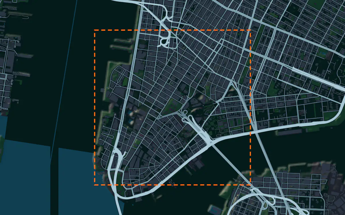
A site model
Lower Manhattan is where the street grid gives way to the older, irregular pattern of the colonial city, and the ground is written into that change. A terrain model of the extent shows the gentle rise from the rivers to the interior and the filled land at the water edge, which is why the waterfront streets sit where they do.
Density is the defining fact of the context. Extruded footprints give a presentation model the canyon streets of the Financial District, and a camera at street level shows what a new tower does to the light. The imagery draws the harbor edge, the bridge approaches and the small plazas between the blocks. Designers take the Lower Manhattan bundle into Unreal, Revit, AutoCAD, and more.
A feasibility kit
Lower Manhattan lots are small, expensive and tightly bounded, so a feasibility look is a look at the lot and its neighbors. The figures above list which public parcel layers reach this ground, and the bundle clips each to the same boundary as the terrain and footprints.
Water is the island-wide risk. Low-lying land along the harbor sits in mapped flood zones, and the public flood map, where it reaches the site, belongs in the first drawing beside the contours. This is public data for early screening, not a survey; confirm boundaries and grades with a licensed surveyor.
Next: topography and contours for a large tract and a Civil 3D surface from lidar.
Public data for concept grading. Confirm boundaries and grades with a site survey.
Frequently asked
Can I model midtown or Brooklyn instead of Lower Manhattan?
Yes. Draw your own area over midtown, a borough or anywhere in the metro and the bundle is built for that boundary.
Can I see harbor flood zones on a Lower Manhattan site?
Where the public flood map reaches your boundary, it ships beside the terrain, and you can read it against the contours for the lot.
Keep the data for New York.
Open the pre-drawn 1,201 acres in the curator, move or resize it, and download a bundle you keep.
Native plugins: Mantle Place for Unreal, Mantle Place for Revit, and Mantle Place for AutoCAD.
Open this area in the curator