
Tampa site model and feasibility data
Elevation, aerial imagery, building footprints, roads and more for downtown Tampa, between the Hillsborough River and the bay, in files you keep.
Mantle Place builds a site model of Tampa: elevation, aerial imagery, buildings and more, in one georeferenced bundle. The pre-drawn area covers downtown Tampa: 1,197 acres, with public parcel records in reach.
What a bundle carries here
- Area
- 1,197 acres (4.8 km²). Downtown Tampa, from the Hillsborough River and the Riverwalk through the core to the Channel District on the bay side.
- Price
- $15 for the pre-drawn area, once. Keep the files.
- Elevation
- USGS 3DEP 1 m (1 m here), then 3DEP 1/9″ (3.42 m here), then 3DEP 1/3″ (10.26 m here). Mapterhorn (30 m) backs it.
- Imagery
- NAIP aerial photography where it covers the site, otherwise Copernicus Sentinel-2, in the bundle.
- Buildings and roads
- Building footprints and the road network ship for the area.
- Flood map
- FEMA flood zones ship for the area.
- Parcels
- Statewide, from Florida Department of Revenue, Property Tax Oversight (statewide parcel map, from the 67 county property appraisers)
- Zoning
- No public zoning source covers this area yet.
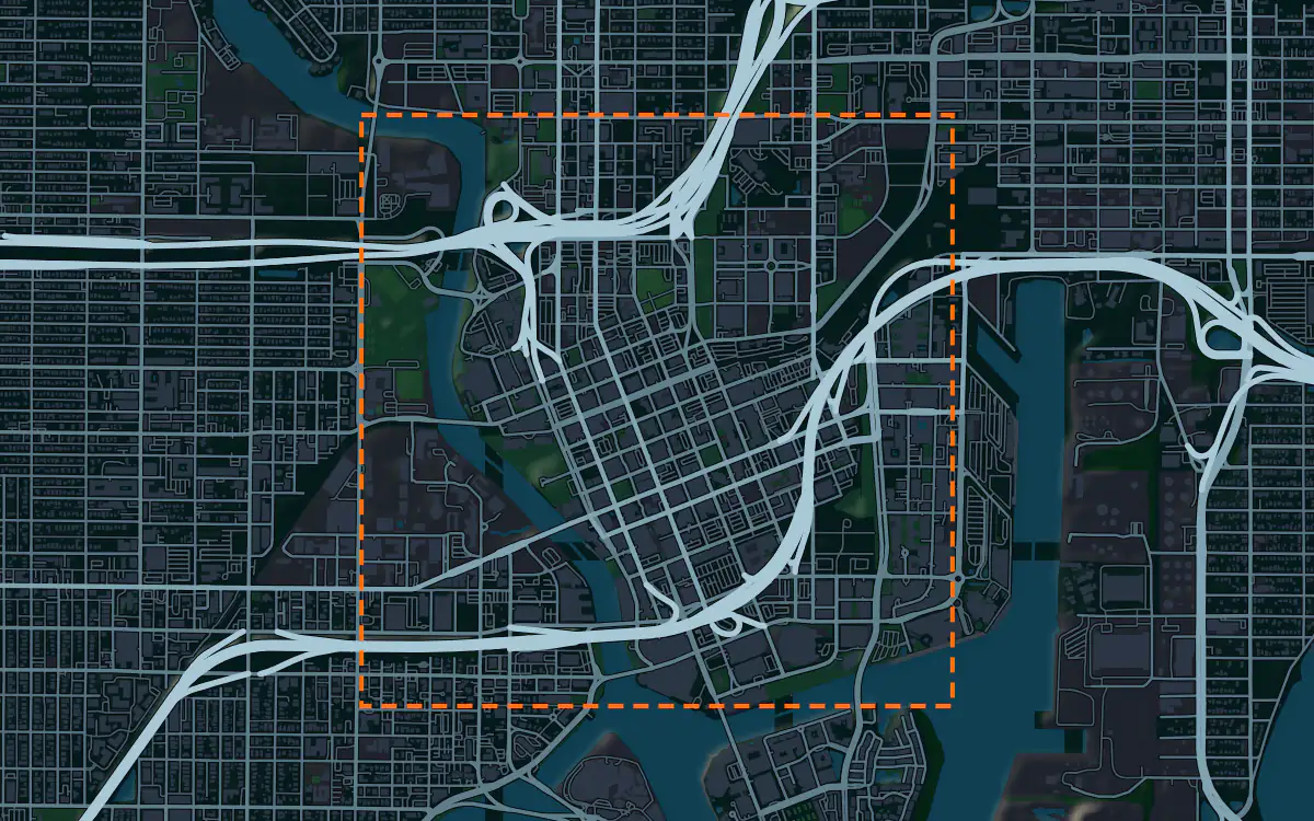
A site model
Tampa is a low peninsula city. The Hillsborough River bends along the west side of downtown, the bay lies to the south, and the ground between barely rises above them. A terrain model of the extent shows those small rises, which is where a downtown design decides whether a site is wet or dry.
The context is a river walk lined with parks and museums, a bay-front convention and cruise district and a university whose silver domes are a roofline that marks the waterfront. Extruded footprints give a presentation model that mix, and the imagery draws the bridges, the marinas and the shoreline. Designers take the downtown Tampa bundle into Unreal, Revit, AutoCAD, and more.
A feasibility kit
Bayside land is judged on flood and surge before anything else, and the contours from the bundle show how high a lot stands. A civil engineer confirms the floodplain before design starts.
A developer can read the lot and its elevation together, then compare tracts side by side. It is public data for early screening, not a survey; confirm boundaries and grades before you close.
Next: topography and contours for a large tract and a Civil 3D surface from lidar.
Public data for concept grading. Confirm boundaries and grades with a site survey.
Frequently asked
Can I model across the bay in St. Petersburg or Clearwater?
Yes. Draw your own area over either city and the bundle is built for that boundary, within the order maximum.
Does the Tampa bundle show storm surge?
The bundle carries the public flood map where it reaches your boundary, beside the elevation. Read the two together for a screening view, and have an engineer confirm the floodplain.
Keep the data for Tampa.
Open the pre-drawn 1,197 acres in the curator, move or resize it, and download a bundle you keep.
Native plugins: Mantle Place for Unreal, Mantle Place for Revit, and Mantle Place for AutoCAD.
Open this area in the curator