
Wake County site model and feasibility data
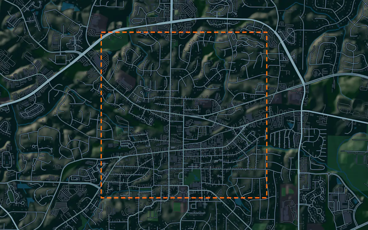
Elevation, aerial imagery, building footprints, roads and more anywhere in Wake County, opened here on downtown Cary.
Mantle Place builds a site model of Wake County: elevation, aerial imagery, buildings and more, in one georeferenced bundle. The pre-drawn Wake County area covers downtown Cary: 1,197 acres, with public parcel and zoning records in reach.
What a bundle carries here
- Area
- 1,197 acres (4.8 km²). Downtown Cary in Wake County, around Academy Street, the town hall campus and the arts center, with the neighborhoods on every side.
- Price
- $15 for the pre-drawn area, once. Keep the files.
- Elevation
- USGS 3DEP 1 m (1 m here), then 3DEP 1/9″ (3.42 m here), then 3DEP 1/3″ (10.27 m here). Mapterhorn (30 m) backs it.
- Imagery
- NAIP aerial photography where it covers the site, otherwise Copernicus Sentinel-2, in the bundle.
- Buildings and roads
- Building footprints and the road network ship for the area.
- Flood map
- FEMA flood zones ship for the area.
- Parcels
- Statewide, from NC OneMap, North Carolina Center for Geographic Information and Analysis (from county data)
- Zoning
- Wake County and its towns, from Wake County (layers maintained with each town)
A site model
Wake County is Piedmont country: low ridges, small creeks and a tree canopy that hides most of the ground from the air. A lot that looks level on a plat can fall a storey from one corner to the other, and the creeks that drain toward the Neuse and the Cape Fear set where a building can go. A terrain model of the parcel and its neighbors shows those ridges and draws before a design team picks a pad.
The canopy matters to the design story too. Cary in particular prizes its trees, and a context model that drapes aerial imagery on the terrain shows the stands a scheme should keep and the edges it should respect. Extrude the footprints around downtown Cary and the new park, the town hall and the older mill-town blocks give the model a scale a client recognises.
Outside downtown the same bundle works for the subdivisions, schools and office parks that keep filling the county. Draw the parcel and import the bundle, and the model shows how a new building sits against the houses and the woods around it. Designers take the downtown Cary bundle into Unreal, Revit, AutoCAD, and more.
A feasibility kit
Wake County has been one of the fastest-growing counties in the country, and much of that growth lands on wooded tracts at the edge of Cary, Apex, Holly Springs and Wake Forest. The first look at a tract is the same every time: its size in acres, the lot lines, the zoning, and the shape of the ground. The figures above list which public lot and district layers reach this ground, and the bundle sets each one beside the terrain.
Streams are the local constraint. Riparian buffers along the creeks in the Neuse basin can take a real share of a rolling tract out of play, and the low ground beside them is often in a mapped flood zone. The contours and the flood map together show where the buildable land is before a civil engineer walks the site.
Pull the contours and the surface into Civil 3D for concept grading, compare a few tracts side by side, and take the best one to a surveyor. It is public data for screening and early design, not a survey.
Next: topography and contours for a large tract and a Civil 3D surface from lidar.
Public data for concept grading. Confirm boundaries and grades with a site survey.
Frequently asked
Can I get a site model for anywhere in Wake County, not just Cary?
Yes. Draw your own area anywhere in the county, from Raleigh to Wake Forest, and the bundle is built for that boundary.
How do I see stream buffers and flood zones on a Wake County tract?
Read the flood map and the contours in the bundle against the tract to see the low ground along its creeks. The buffer widths themselves come from the state and the town, so confirm them before you plan around them.
Keep the data for Wake County.
Open the pre-drawn 1,197 acres in the curator, move or resize it, and download a bundle you keep.
Native plugins: Mantle Place for Unreal, Mantle Place for Revit, and Mantle Place for AutoCAD.
Open this area in the curator